Castle Douglas, Loch Ken e New Galloway - Castle Douglas, Loch Ken and New Galloway
OS Explorer è la mappa più dettagliata dell'Ordnance Survey ed è...
Newport e Pontypool / Casnewydd a Phont-Y-Pwl - Newport and Pontypool / Casnewydd a...
OS Explorer è la mappa più dettagliata dell'Ordnance Survey...

Valle di Ancholme - Ancholme Valley
OS Explorer è la mappa più dettagliata dell'Ordnance Survey ed è consigliata a tutti coloro che praticano attività all'aperto come...

Nithsdale e Annandale, Sanquhar e Moffat - Nithsdale & Annandale, Sanquhar & Moffat
La serie OS Landranger Active Map copre la Gran Bretagna con 204...
Stroud, Tetbury e Malmesbury - Stroud, Tetbury and Malmesbury
OS Explorer è la mappa più dettagliata dell'Ordnance Survey ed è consigliata a tutti coloro che...

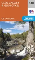
Glen Cassley e Glen Oykel - Glen Cassley and Glen Oykel
OS Explorer è la mappa più dettagliata dell'Ordnance Survey ed è consigliata a tutti coloro che praticano...
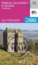
Peebles, Galashiels e Selkirk, Valle del Tweed - Peebles, Galashiels & Selkirk, Tweed...
La serie OS Landranger Active Map copre la Gran Bretagna...
Loch Morar e Mallaig - Loch Morar and Mallaig
OS Explorer è la mappa più dettagliata dell'Ordnance Survey ed è consigliata a tutti coloro che praticano attività...

Fort Augustus, Glen Roy e Glen Moriston - Fort Augustus, Glen Roy & Glen Moriston
La serie OS Landranger Active Map copre la Gran Bretagna con 204...