Glen Cassley e Glen Oykel - Glen Cassley and Glen Oykel
OS Explorer è la mappa più dettagliata dell'Ordnance Survey ed è consigliata a tutti coloro che praticano...
Peebles, Galashiels e Selkirk, Valle del Tweed - Peebles, Galashiels & Selkirk, Tweed...
La serie OS Landranger Active Map copre la Gran Bretagna...
Loch Morar e Mallaig - Loch Morar and Mallaig
OS Explorer è la mappa più dettagliata dell'Ordnance Survey ed è consigliata a tutti coloro che praticano attività...
Fort Augustus, Glen Roy e Glen Moriston - Fort Augustus, Glen Roy & Glen Moriston
La serie OS Landranger Active Map copre la Gran Bretagna con 204...
Alta valle del Clyde, Biggar e Lanark - Upper Clyde Valley, Biggar & Lanark
La serie OS Landranger Map copre la Gran Bretagna con 204 mappe dettagliate,...
Basingstoke, Alton e Whitchurch - Basingstoke, Alton and Whitchurch
OS Explorer è la mappa più dettagliata dell'Ordnance Survey ed è consigliata a tutti...
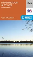
Huntingdon e St.Ives, Grafham Water - Huntingdon and St.Ives, Grafham Water
La mappa essenziale per le attività all'aperto a Huntingdon, St Ives e...
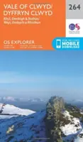
Vale of Clwyd, Rhyl, Denbigh e Ruthin - Vale of Clwyd, Rhyl, Denbigh and Ruthin
La mappa essenziale per le attività all'aperto nella Vale of Clwyd,...
St.Austell, Liskeard, Fowey, Looe e Lostwithiel - St.Austell,Liskeard, Fowey, Looe and...
OS Explorer è la mappa più dettagliata dell'Ordnance...